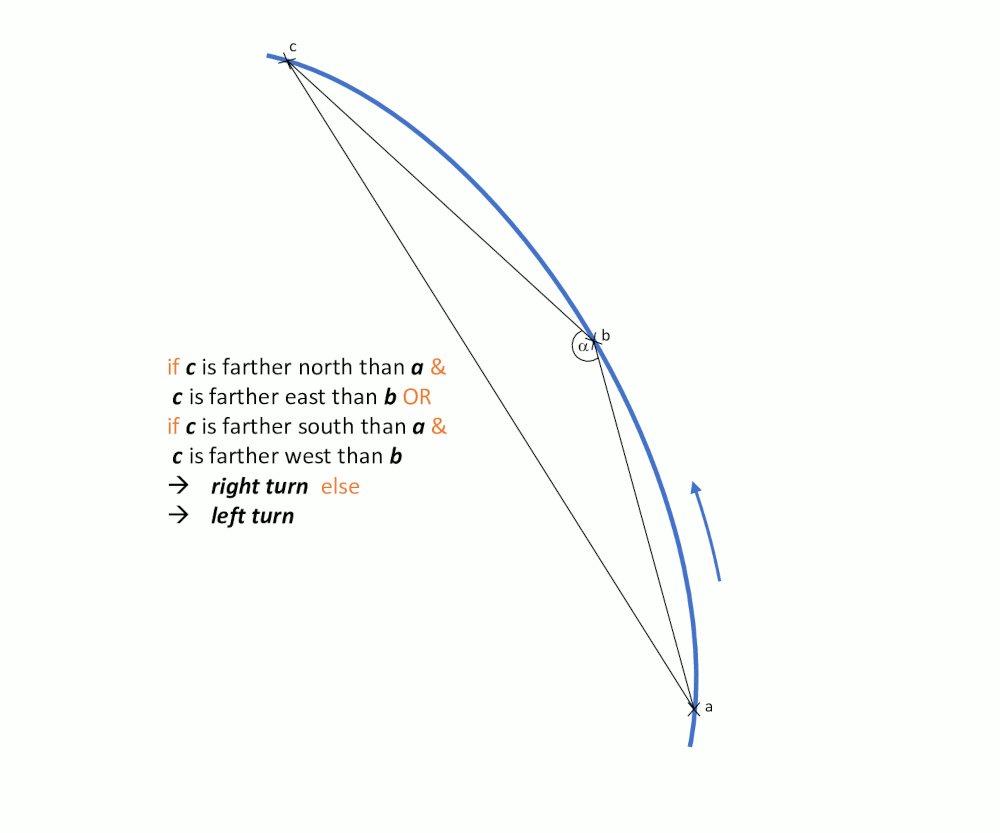
Calculates the steepness and direction of river curves. It uses
the coordinates of three consecutive hectometer points (sf.hectometer)
along the rivers axis (sf.axis) and determines the inner angle of the
resulting triangle adjacent to the middle point (b). The direction is
derived as described in getCurve.
Arguments
- x
must be a single
integerindexing one hectometer polygon ofsf.afe_csaalong the River Elbe.xmust be element ofseq(from = 1, to = length(sf.afe_csa), by = 1).
Value
list with items value (numeric)and txt (character)
indicating the direction c("left", "right").
Examples
   getAngle(3900)
#> Warning: attribute variables are assumed to be spatially constant throughout all geometries
#> $value
#> [1] 1.557835
#>
#> $txt
#> [1] "right"
#>
   getAngle(3963)
#> Warning: attribute variables are assumed to be spatially constant throughout all geometries
#> $value
#> [1] 1.006967
#>
#> $txt
#> [1] "right"
#>